Advanced
This module introduces students to using the active seismic method and illustrates how geophysics can inform engineering projects in an urban environment. Students are first introduced to seismic data as individual waveforms, allowing them to explore the relationship between wavelength, frequency, and travel time. They explore the fundamental equation governing seismic refraction, Snell's Law, and then use seismic refraction data to interpret subsurface geology from a small survey on the University of Wyoming campus. Finally, they use seismic refraction data to evaluate the subsurface geology for an urban renewal project along Codorus Creek in York, Pennsylvania.
Students can collect and analyze their own seismic refraction data, using instruments available at the EarthScope Primary Instrument Center (instructions for making an educational use request are on the EarthScope Geophysics Field Education page).
A great fit for courses in:
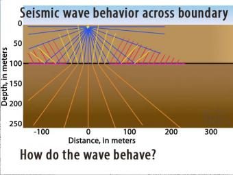
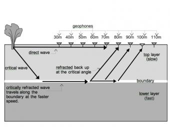
Seismic waves travel at different speeds through different materials. In this 2-layer model two wave fronts leave an impact at the same time but the lower layer is faster.
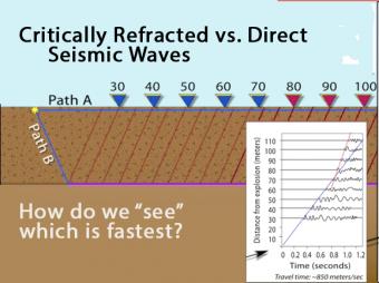
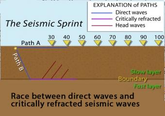
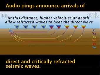
Animation shows the race between the direct seismic wave vs. the deeper, longer-path critically refracted seismic wave. Graph records the arrival times.
In this model of increasing velocity with depth, the critically refracted seismic rays speed up with depth as they pass 5 different velocity boundaries.
Like other waves, seismic waves obey the laws of physics. In this activity Physics students have the opportunity to apply their understanding of the basic concepts of waves (e.g. reflection, refraction and transmission of energy) as they examine seismic data to determine how far it is from the surface to the bedrock.

In this module students learn to conduct terrestrial laser scanner (TLS) and/or Structure from Motion (SfM) surveys to address real field research questions of importance to society. Both geodetic methods generate high resolution topographic data and have widespread research applications in geodesy, geomorphology, structural geology, and more.
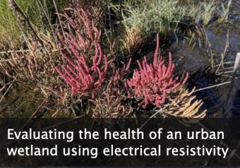
This module emphasizes how electrical resistivity is used as a proxy for measuring salinity in a wetland just outside of New York City, and how the presence of an indicator species is used as a proxy for ecosystem health. Comparing these data illustrates how cities impact the environments around them.
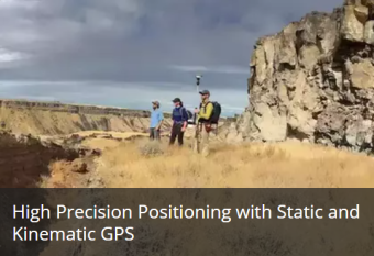
This module introduces students to global navigation satellite systems (GNSS, a more universal term than GPS). It focuses on static and kinematic methods, and shows examples for use in measuring topography and change detection.
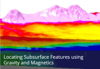
This module discusses gravity and magnetics geophysics field techniques and how to use them, including identifying buried objects and exploring the environment.
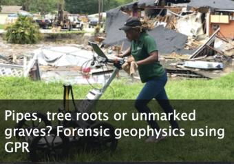
This module considers the capabilities and limitations of ground-penetrating radar (GPR) in urban/highly developed settings and for forensic applications. Students are asked to draw on their current understanding of common medical imaging methods and draw comparisons to GPR.
We encourage the reuse and dissemination of the material on this site as long as attribution is retained. To this end the material on this site, unless otherwise noted, is offered under Creative Commons Attribution (CC BY 4.0) license